Hiking in the Lake District - Off the Beaten Track in Wasdale
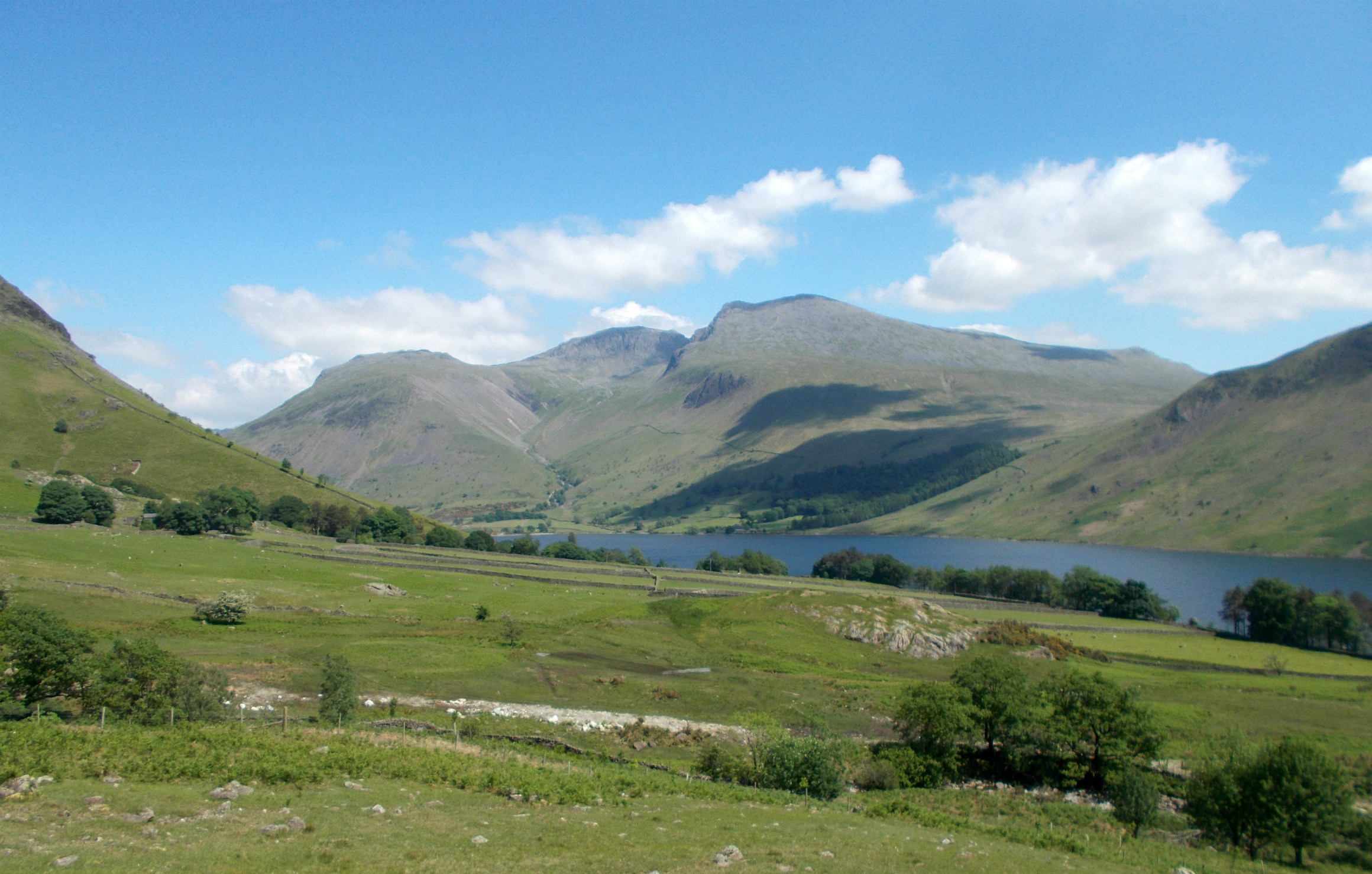
For those unfamiliar with the English Lake District which lies in the county of Cumbria bordering the Solway Firth and Morecambe Bay, the Wasdale valley lies in the relatively remote and unpopulated western part of the National Park but despite this still receives a large number of visitors. This is in no small part due to its situation at the foot of England's highest mountain Scafell Pike (final picture) which rises to 978m or 3210ft and is a popular ascent from here. Aside from this steep and stony hike, there are many more fine walks that start from here - including this one. The hamlet is also home to the country's smallest church - St Olaf's and deepest lake Wastwater. Some of the local place and hill names do not look English and indeed many of them originate from the Norse from when the Vikings farmed the land around here.
The recent fine weather saw me heading off to Wasdale for what had been planned as a few days cycling and camping with my cousin Brian, though plans were quickly changed when he suffered a training injury and had to bail at the last minute. Overdid it on the burpees apparently! I went to Wasdale anyway but minus the bike and headed for the hills instead. In a bid to avoid the bank holiday weekend crowds flocking to Scafell Pike and Great Gable, I opted to launch a second attempt on a hill that had defeated me on a previous occasion owing to weather and distance.
I had nicknamed Caw Fell the farthest away mountain owing to its distance from my Wasdale camp and its status as the remotest of all of the Wainwrights (Lakeland fells or mountains) from human habitation. The height is modest but it does lie in the empty quarter between Ennerdale Water and the uninhabited marshy tract of Blengdale - a valley that few visitors to Lakeland have even heard of let alone visited.
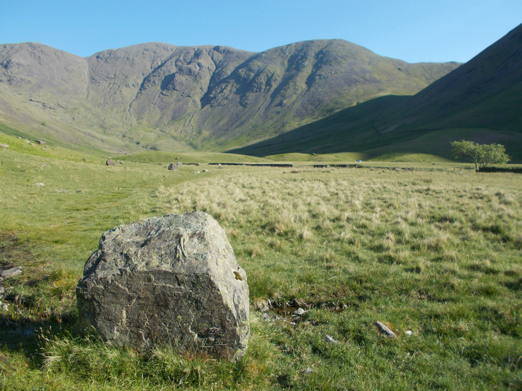
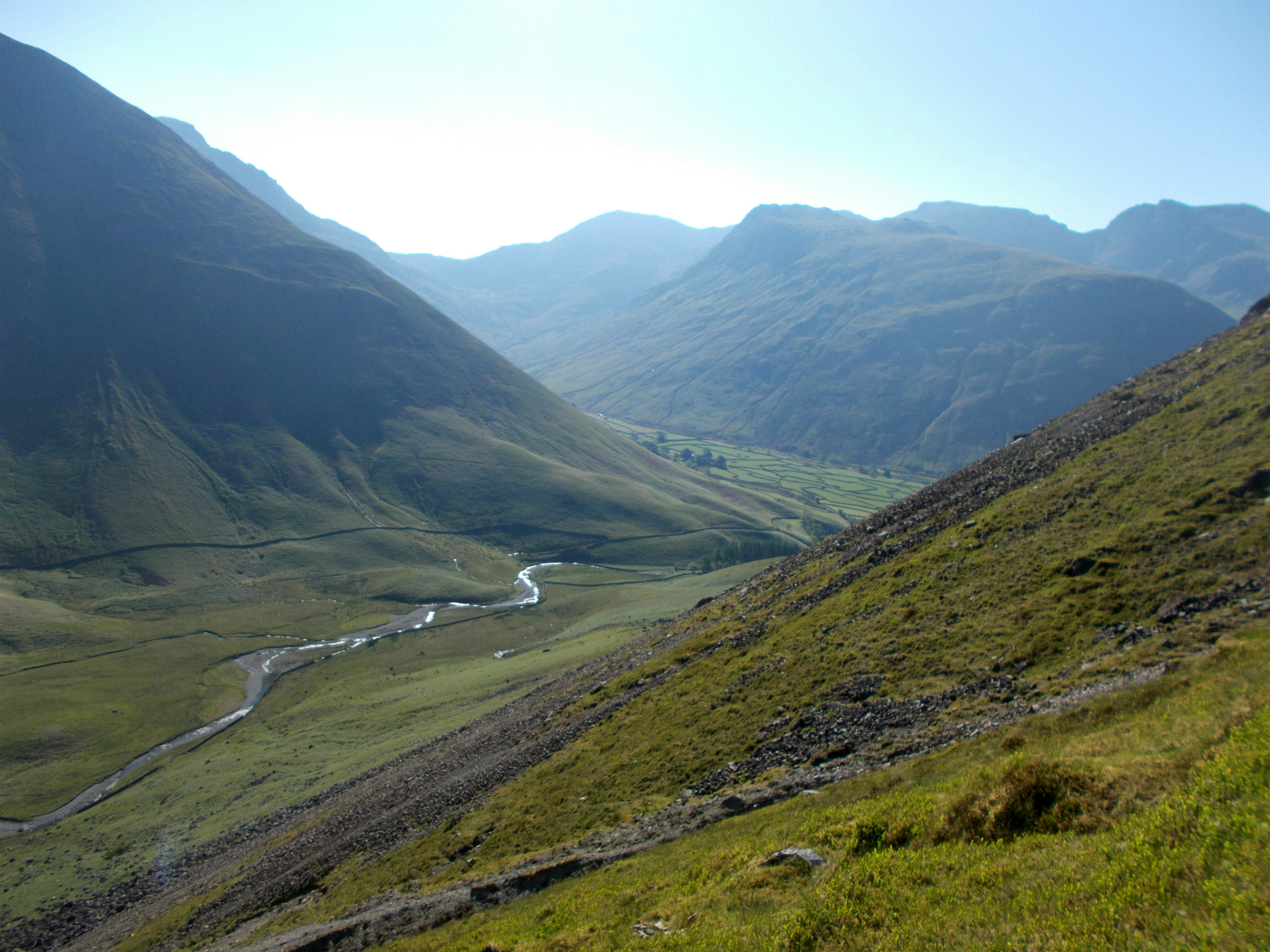
So it was that I set out from the National Trust campsite to walk up the lane to Wasdale Head and crossed the stone bridge over Mosedale Beck immediately behind the inn. Here a good path led into Mosedale beneath the craggy ramparts of Yewbarrow, on the opposite side of the beck to the Black Sail track which leads to the pass and the youth hostel of the same name and into Ennerdale or on to Buttermere.
Presently Red Pike, my first objective, could be seen ahead and well over 2000 feet above. The way to it led past a scree slope and then steeply up towards the col known as Dore Head that separates Yewbarrow from Red Pike. Going up here is hard work however you look at it and on a warm June morning it was challenging. In the upper stages the angle of the slope is a sustained 45 degrees and it's important when resting to keep hold of items such as cameras and rucksacks as retrieving them from a thousand feet down the slope is simply not an option. Thankfully the steep and unstable looking scree slope could be avoided on a path to its right and eventually Dore Head was reached where I could rest on level ground once more.
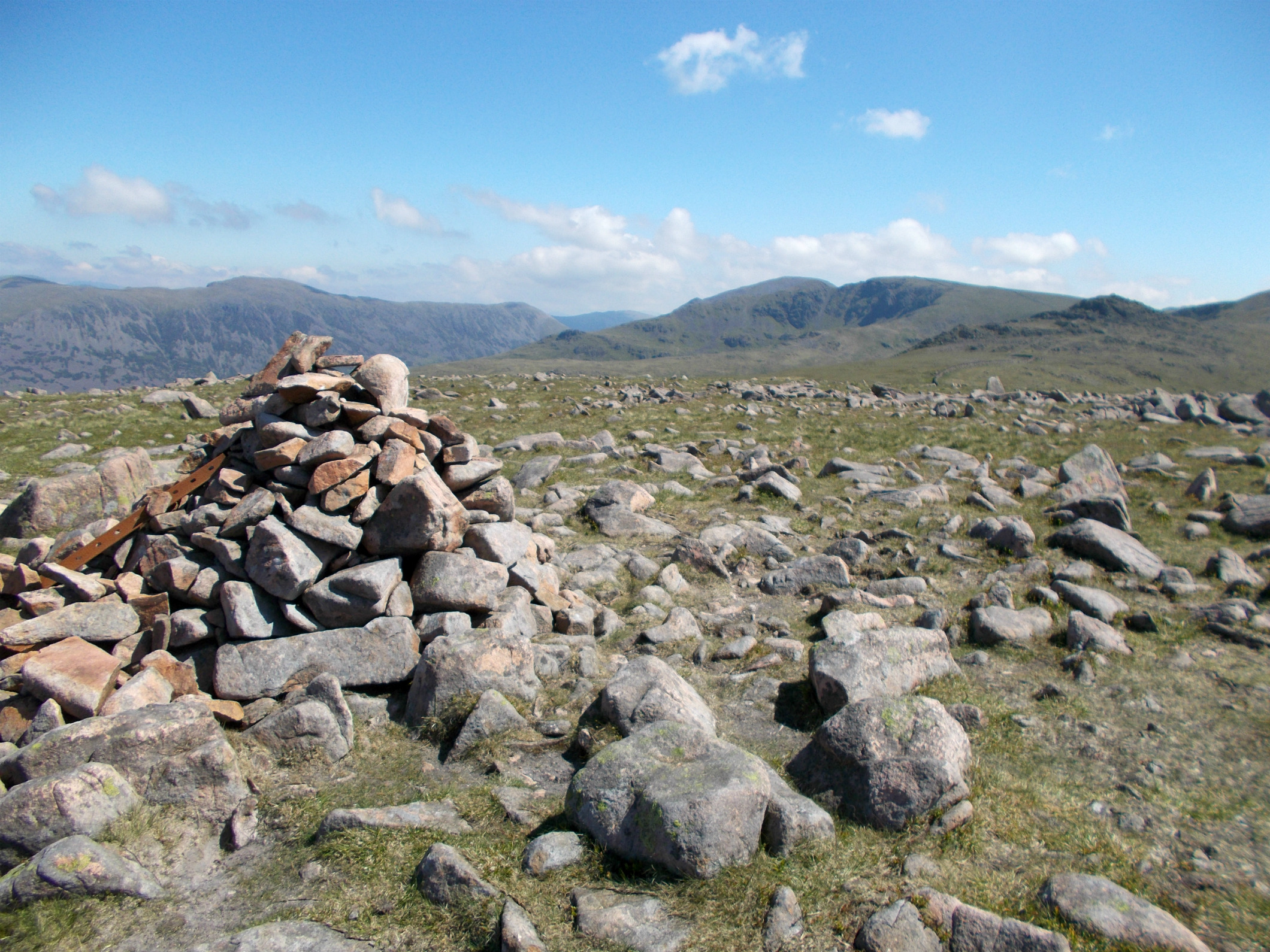
From here one turns right towards Red Pike which rises in a series of grassy steps interspersed by short easy rocky sections. The main cairn on Red Pike lies at 2629 feet above the Irish Sea which was visible to the west, which is curious as the summit is just a little further on at 2707 feet. Here the much smaller cairn is perched in a splendid location atop the precipice that falls to Mosedale.
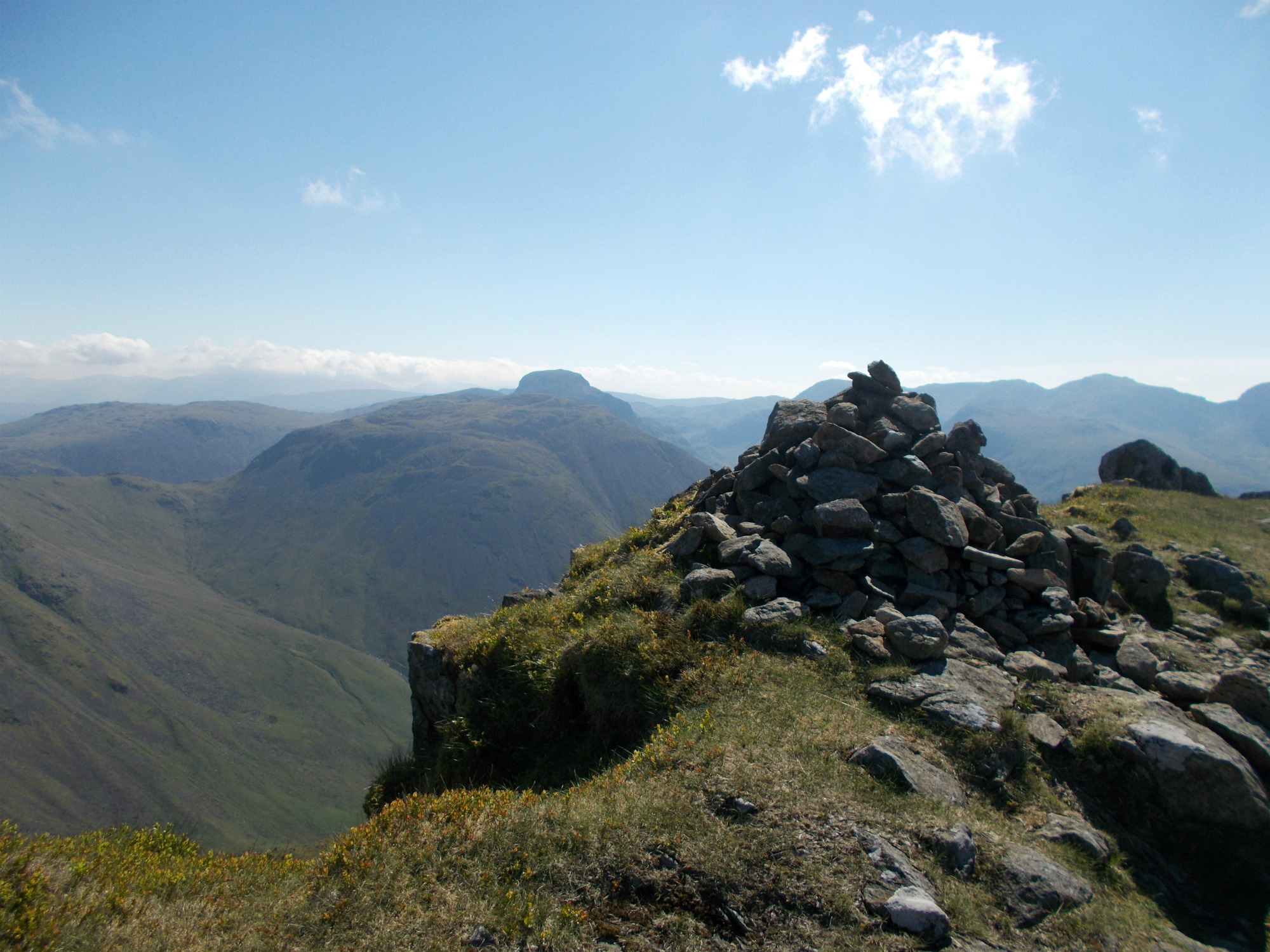
From Red Pike my route lay down the broad ridge ahead and up to Scoat Fell, a direct approach is best from the depression as the path bears right towards Pillar. That is the route of the Mosedale Horseshoe which circuits via Pillar, Black Sail Pass and Kirk Fell; a fine route but not the one I was following today. The top of Scoat Fell was the day's highpoint at 2760 feet though I decided against visiting the peak of Steeple which lies ten minutes along a short narrow ridge on the Ennerdale side. If you haven't done it before it's a must - one of the finest summits in the Lake District - but I still had a long way to go and didn't want to be out in the sun for longer than needed.
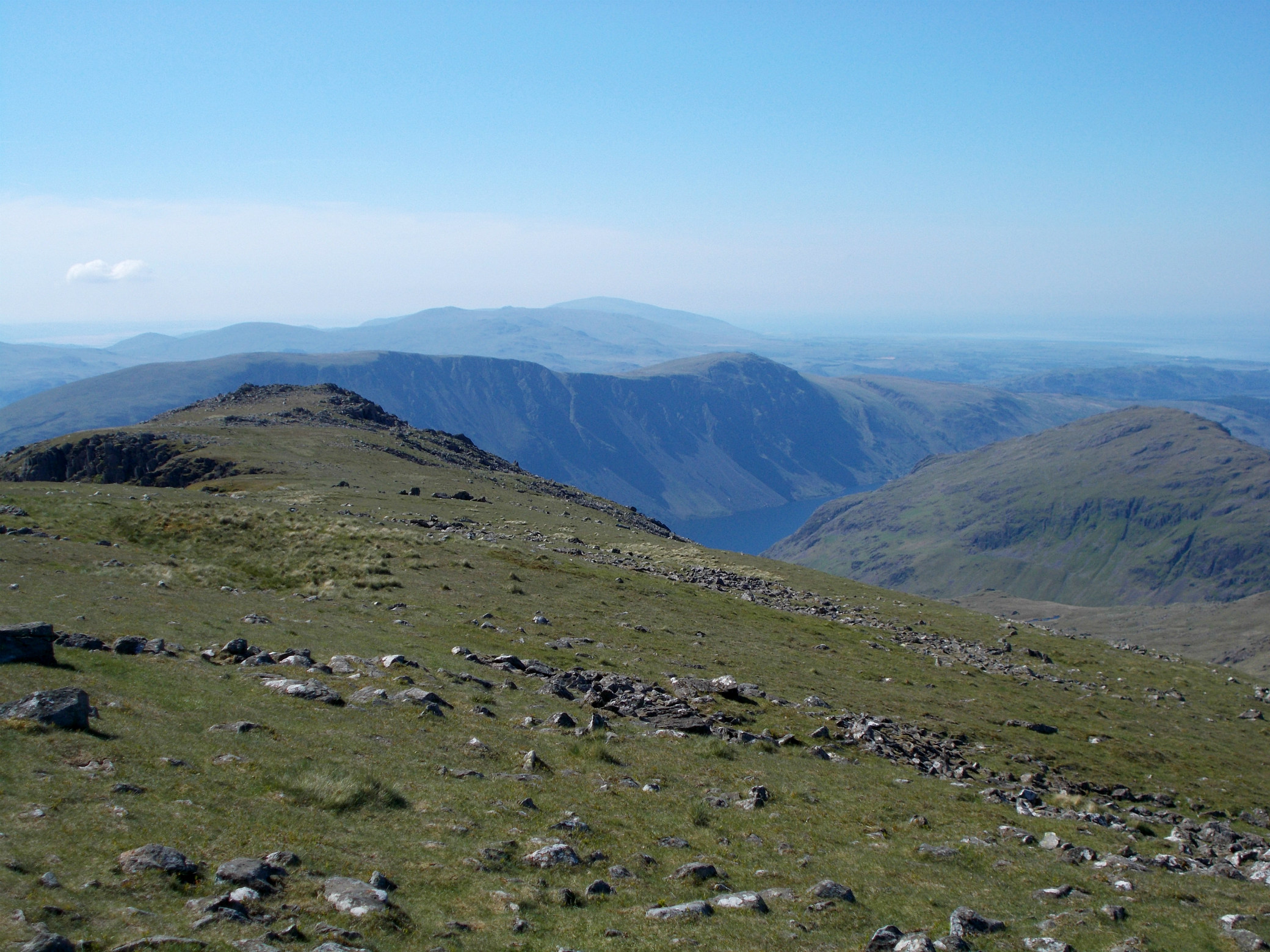
From Scoat Fell I headed westwards down a wide grassy slope towards the rounded dome of Haycock. Passing the less obvious path to the left by a cairn at the lowest point, which would be my route back to Wasdale, I toiled up to the top of Haycock in a sun that was becoming more ferocious as the day went on. It was around 26-27 degrees (around 80 fahrenheit) in the valley which made a pleasant change from the norm but the uphill sections were harder going and I was glad to have done the main climb out of the valley in the cool of morning. From the stony top of Haycock the path led down the far side to grassy ground once again and skirted the craggy bluff of Little Gowder Crag well to the left. If you're a peak bagger doing the two thousanders then you have to go up there - for us doing the Wainwrights, bypassing it will do. Now it was just a case of following the wall - there is a path on both sides - all the way along to the small cairn marking the summit of Caw Fell.
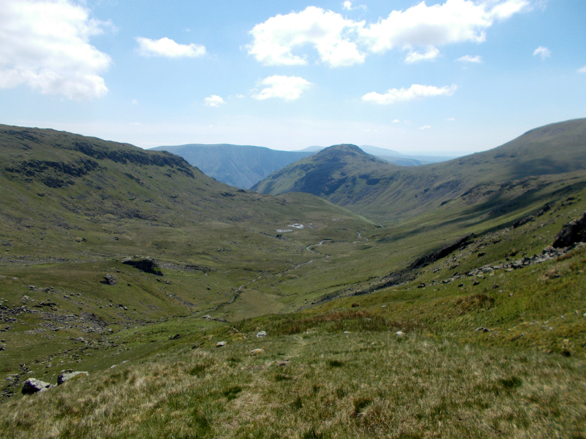
This summit doesn't match Steeple or Red Pike for dramatic position but it is a place of wild beauty where the hills roll to the distance on all sides, and on a day like this it was unrivalled as a place to rest and have lunch. On a wet or misty day I would imagine it would not be so appealing. The isolation meant though that I still had a fair walk - including a second ascent of Haycock - to get back to the valley. I retraced my steps to the cairn on the col between Haycock and Scoat Fell and headed right - down into the side valley of Nether Beck where, after a pleasant downhill walk of nearly four miles I emerged at Nether Beck Bridge. This path is patchy in its upper sections though lower down it becomes much clearer while glimpses of Wastwater guide the weary walker back to civilisation.
In all this is a trip of just over 12 miles with 3650 feet of ascent that visits four Wainwrights; Red Pike 2707ft, Scoat Fell 2760ft, Haycock 2618ft and Caw Fell 2288ft. There is the option to add Steeple (2687ft) if you haven't been there before by adding half an hour to the walk or Yewbarrow (2058ft) by adding rather more. The ascent of the latter involves a rocky scramble from Dore Head and is probably best done separately - especially if Caw Fell is an objective.
Originally posted at my Lake District walking and hiking blog "http://lakeland-walks.blogspot.com
upvote for me please? https://steemit.com/news/@bible.com/2sysip
beautiful story
this looks like a gorgeous place to paraglide! adding it to my list of places to check out ;) thanks for the post!