The Faroe Islands
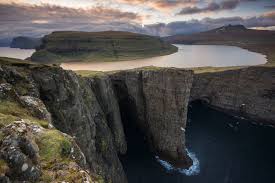
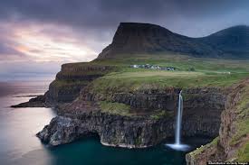
The Faroe Islands is a self-governing archipelago, part of the Kingdom of Denmark. It comprises 18 rocky, volcanic islands between Iceland and Norway in the North Atlantic Ocean, connected by road tunnels, ferries, causeways and bridges. Hikers and bird-watchers are drawn to the islands’ mountains, valleys and grassy heathland, and steep coastal cliffs that harbor thousands of seabirds. Faroe Islands are 172.9 km2 (66.8 sq mi). Around 50.000 people live in the Faroe Islands.
.jpg)
The 18 Islands are : Fugloy, Svínoy, Borðoy, Viðoy, Kunoy, Kalsoy, Eysturoy, Streymoy, Mykines, Vágar, Koltur, Hestur, Nólsoy, Sandoy, Skúvoy, Stóra Dímun, Lítla Dímun and Suðuroy. 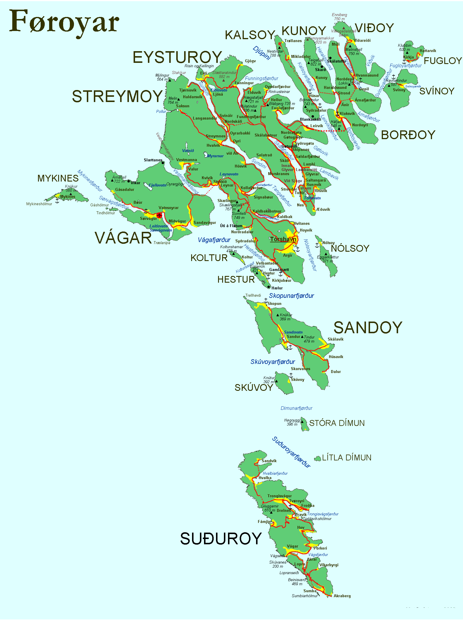
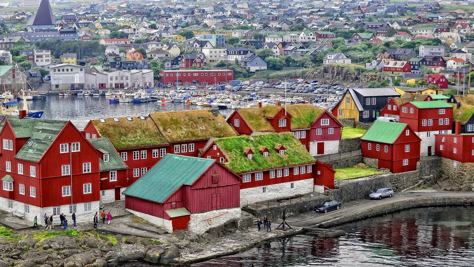
Thórshavn is the capital and largest town in the Faroe Islands. The town proper has a population of 13,089 (2017), and the greater urban area a population of 21,000.
The Norse established their parliament on the Tinganes peninsula in AD 850. Tórshavn thus became the capital of the Faroe Islands and has remained so ever since. All through the Middle Ages the narrow peninsula jutting out into the sea made up the main part of Tórshavn. Early on, Tórshavn became the centre of the islands' trade monopoly, thereby being the only legal place for the islanders to sell and buy goods. In 1856, the trade monopoly was abolished and the islands were left open to free trade.