Hiking on the Pacific Crest Trail
On a Saturday morning, last July, I went for a hike in the Mount Jefferson wilderness area. This is the last year before the Willamette National Forest will turn the entire Mt Jefferson Wilderness area into a reservation system only so this will probably be the last time I’ll be able to do same day hiking, now I will actually have to plan. When I first moved to Oregon, hardly anyone had heard of these places except for the locals. Then after 15 years of population growth in the Willamette Valley and all the local newspapers saying how great of an area it is, it has turned into a no longer best kept secret. The reservation system will be an adjustment for the majority since I truly believe most people have never heard of it and won’t know of it until they show up at trailheads next summer. Then I feel there will much non compliance and forest rangers will be writing a number of tickets in 2020. Make sure you bring your ID when you go hiking, otherwise, they will have no way to prove who you are….wink wink. Seriously, obey the “law” and take care of the forest.
Since the Whitewater Trail has been closed for the last two years due to the 2017 fire (recently reopened Aug 1st, 2019 but please check the website). I decided to go up the southern side on Woodpecker Ridge Trail. This area was still burned like Whitewater Trail but I guess not nearly as bad but it was still bad. Headwear and sunscreen is highly recommended on this trail. Just like with all trails going into the Jefferson Wilderness, it is very uphill at first and then comes down a bit before it intersects with the Pacific Crest Trail. The trail is 1.5 miles to the PCT. Go south for Pamelia Lake (a very out limits lake, reservations have required for a while there) or north for Jefferson Park. Jefferson Park is a park like none other. There are several mountain lakes up there, most of the time, they are frozen over. The perfect time to swim up there is mid July to early Sept but there have been times I’ve up there on Labor Day and there is still snow on the ground.
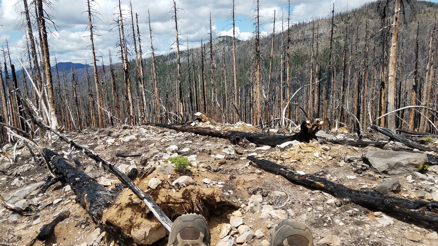
The PCT, going around the west side of Mt Jefferson, is a burned out area from 2017. Many signs state flash floods are possible during heavy rains. Looking around the area, that is very possible.
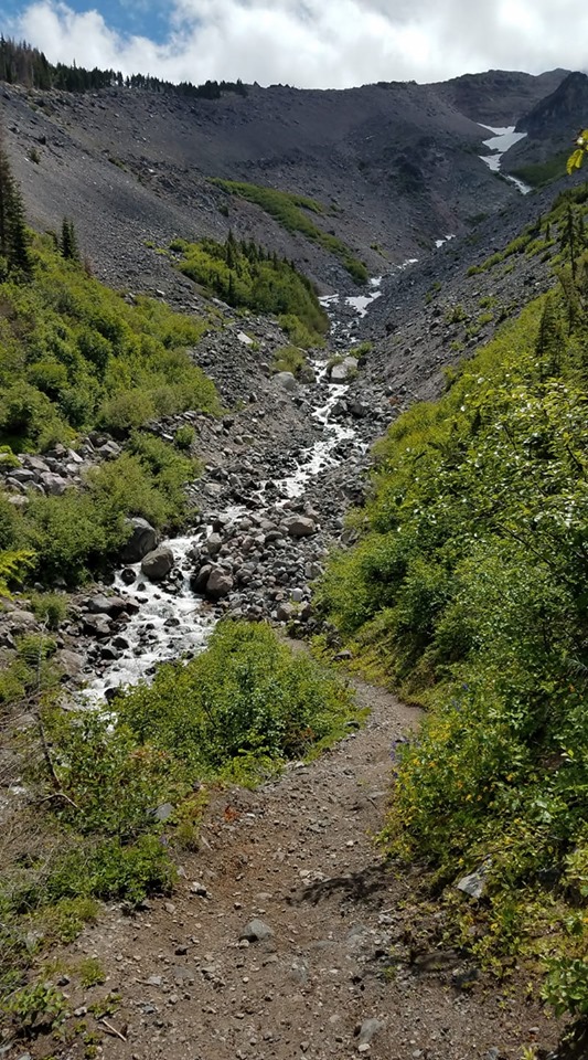
Some parts of the PCT were green, but most on this section, were burned. There were a lot of rocks and a lot of burned up trees. I met several people on the trail, many thru hikers on the PCT. At this point in the trail, they are about ¾ complete with the trail and way ahead of schedule. My trip this day was shorten by Russell Creek. This creek comes straight from the glaciers on Mt Jefferson. By this point in my trip, it was very steep on the other side and it was getting late. I turned around at this point. It was a beautiful day, as you can see.