Map As Source of History
ONCE THE TIME, Alfonso de Albuquerque-the Portuguese fleet leader who attacked Malacca in 1511-sent a map that read Javanese letters to the king of Portugal. But unfortunately, Adrian B Lapian wrote in the 16th and 17th centuries of Sailing and Trade of the Archipelago, the ship carrying the map sank in the middle of the road.
In the Portuguese record, the map has been known to sailors from the archipelago to sail in the early 16th century. The revelation of Lapian shows the people of the archipelago have long known the concept of 'space' within the framework of power.
"Actually we already have an idea of the space itself, which I call the knowledge of geography archipelago. In the past, we had the concept of a traditional room, sack pandelengan (one sweep of the eye-ed). What is the concept of pandelengan sack? So reasonable when claiming its territory does not have to make demarcation, it is delineated with sextan tools. But as far as the king can see, it belongs to him, "said Test Nugroho Winardi, historian of the University of Gajah Mada who specializes in cartographic history.
Map making techniques are constantly evolving. It leads to the emergence of cartography, the study of everything about maps, from history, development, manufacture, knowledge, storage, to preservation and ways of using maps. "The cartography was a genuine word appeared in the 19th century, said the Test in the National History Seminar at Gajah Mada University, 14-16 December 2017.
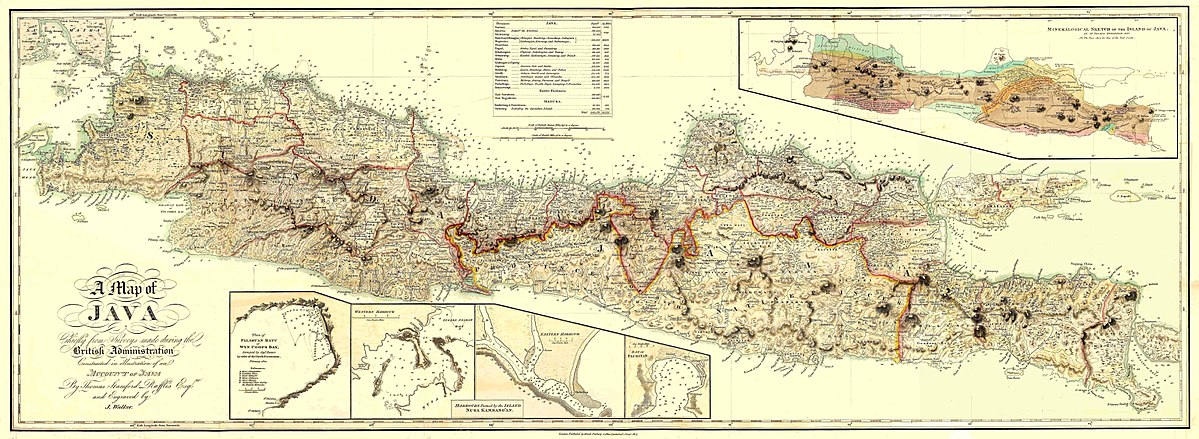
Since the strength of Europe's shipping world to Asia, the map has an important position. He is seen as a lighter the emergence of capitalism. "The sea map of Peter Pancius, entitled Insulae Moluccae Celeberrimae, was made in 1594. It was used by the Dutch trade partners for advertising. So based on this map, they are looking for who wants to plant stock to fund the voyage. This map then spur the emergence of capitalism. The map is mass-produced and for coloring, using women and children to color at home. This spins the wheels of the economy, "said Test.
In historical writing, not many people use the map as a source of history or source of study. The test divides two historical writings focusing on the map, a historical work that examines maps and historical works that use the map as a force in its study.
The earliest work is the Boegineesche Zeekarten van den Indische Archipel of Le Roux which, published in 1935. Le Roux examines the Bugis sea map. "He did an overview of some indigenous maps produced by Bugis. This map is stored in Utrecht, which is then called the pirate map. Then there was the name Jan O Broek, he did geographical naming, which now grows rapidly into toponimi. Toponimi is the original child of cartographic products that mate with other knowledge, "said Uji.
In addition to these two names, there is Ferjan Ommeling. He composed the book Colonial Cartography of the Netherland Indies 1816-1942. Ferjan is the son of Ferjan Ommeling Senior, a man who contributed to Indonesia for transforming Indische Topografische Dienst into Bakosurtanal (National Coordinating Agency for Surveys and Mapping).
Reviewing the map or using the map as a source of history becomes a special value for a historian. By studying or mastering map readings, he will be able to "use maps to write various kinds of historical works such as politics, economics, social and culture; understanding the spatial history of a place; and the theme of state formation, both colonial and national and empire creation became one of the important issues. In this case, the colonial period - especially for the case of Indonesia - becomes very important in the formation of state territory, "said the young historian with a thick mustache.
Understanding of the map or its use as a source of study, in the context of Indonesia becomes important because to this day the calculation of islands throughout Indonesia was not completed.