Across The Roof #Norway# With Helicopter
Across the roof # Norway # With Helicopter.
#Fhoto helicopter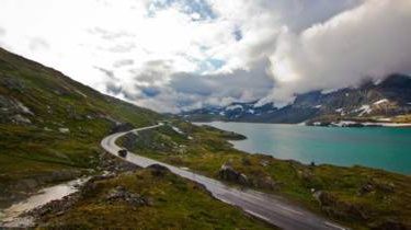
January 30, 2018
Share this article with Facebook .Teuku.Ardy @ ymail.com
Fhoto-fhoto taken from the roof of Norway.
With a 108-kilometer route, Sognefjellet Road that connects the mountains on the western coast of Norway presents fantastic fjord scenery.
#Fhoti taken on helicopter 1
Loaded beauty
Norway's famous mountains, fjords and forests. The beauty of the landscape is no longer a secret. However, one way to see the sights is to drive on the Sognefjellet Street or better known as the 'road that crosses the Norwegian roof'. The Sognefjellet Street, which is one of 18 national tourist routes in Norway, divides fertile valleys, penetrates high mountains and lakes, and connects a number of mountains on the western coast with a charming fjord. Sognefjellet Street also connects travelers to Jotunheimen National Park.
#Fhoto taken over helicopter 2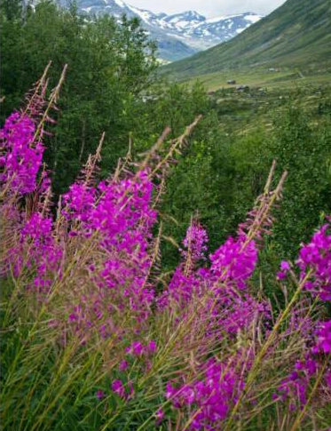
Quiet start
A sense of calm and peace surrounded the moment of the journey on Sognefjellet Street. Slowly the vehicle leaves Lom City in the mountains and begins to slide on the banks of the Bøver River. Occasionally snow-capped peaks appear as they pass through a deserted valley. The journey across Sognefjellet Street should be prepared from afar because for a year the road is only open from May to September. Outside that time, Sognefjellet Street was covered with snow over a meter high. When I passed the first part of the road in early August, the field was filled with purple flowers.
#Fhoto taken over helicopter 3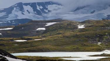
World of giants
Jotunheimen National Park, which literally means 'house of giants', has an area of 1,151 square kilometers and accommodates more than 275 mountains. The mountains are at least 2,000 meters high, including Mount Galdhøpiggen as high as 2,469 meters which is the highest mountain in northern Europe. There is also the Skagastølstind Store Mountain (photo above) which reaches 2,403 meters and is the third highest mountain in Norway. The mountains dominate most of the sights along Sognefjellet Street.
#fhoto taken over helicopter 4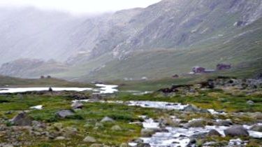
The climber's paradise
Located about 37 kilometers west of Lom Town, the Krossbu Turiststasjon inn is the starting point of the climb in Jotunheimen National Park. From the inn, the most popular climbing route is a 6km walk to the Smørstabbreen glacier foot. There is also a long-distance trek that includes three night trips through the national park through Skogadalsboen lodge lodge and Vettisfossen. 
#Photo taken on helicopter 5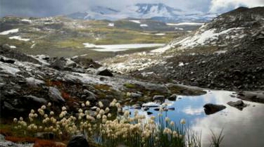
The land is cold and frozen
Although Jotunheimen National Park is located south of the Arctic Circle, its height is quite supportive of climate and flora and fauna typical of the arctic. Summer periods from July to mid August tend to be short and winters are long and difficult. In the photo above looks arctic plants that add color to the rugged mountain scenery.
#Photo taken by helicopter 6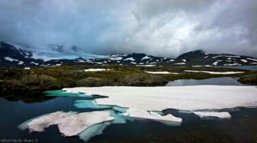
Tears of giants froze
At the highest point on Sognefjellet Street is Smørstabbreen Lake (photo above), 49 kilometers west of Lom City. The Sognefjellet Street, which lies at an altitude of 1,434 meters above sea level, is often regarded as the highest mountain road in northern Europe. Perhaps because of the beauty inspired in this region, the 19th century Norwegian poet, Aasmund Olavsson Vinje, described it as a giant inhabited world and troll. However, when humans find fire, they chase the creatures north until they fall off the edge of the earth. The tears, which the creatures took out when chased, froze into the mountains and lakes around. When the sunny day, Lake Smørstabbreen transformed into the most amazing view witnessed from the roof of Norway. (Photo Above helicopter).


Thanks for visiting blogg @Steem-Norwegia (Alma Al Oslo)