SLC S22W1 / Basic Concepts of Digital Cartography.
Hello everyone
I hope you all are doing Well and enjoying your life. Today I am excited to participate in this learning contest by drawing freehand map of my country Pakistan. I am not very skilled at sketching but its one of my hobbies and I hope I can do it well!
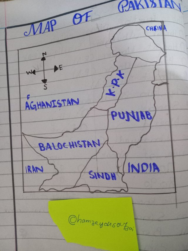
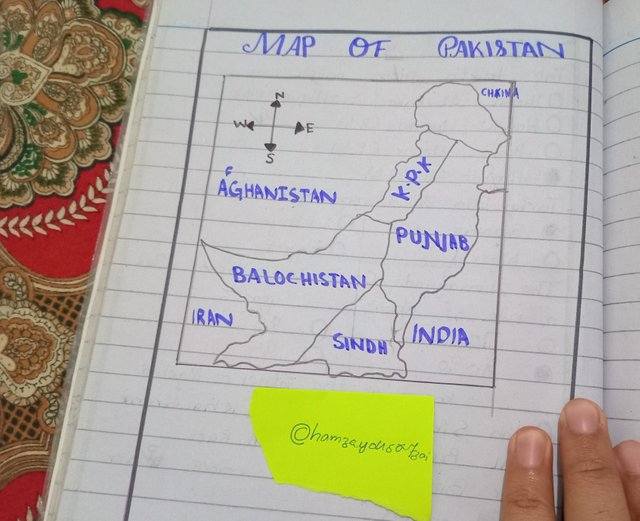
My Freehand Map of Pakistan
I have drawn the map of Pakistan and marked all the provinces. I have been fortunate to visit most of the provinces in my country because I am a YouTube vlogger and often plan trips to explore different places.
How I Drew the Map

Starting Point:
First I wrote the heading "Map of Pakistan" at the top to clearly indicate the subject of my sketch.Drawing the Outline:
I began by drawing the outline of Pakistan. While it’s not perfect I made sure it resembled the actual map as closely as posible.Marking the Provinces:
Using a marker I labeled the provinces of Pakistan:- Punjab
- Sindh
- Khyber Pakhtunkhwa
- Balochistan
- Gilgit-Baltistan
Indicating Directions:
To make the map more detailed I added arrow to indicate the directions: North East West and south.Neighboring Countries:
I also marked the neighboring countries around Pakistan to provide Context:- India to the east
- Afghanistan to the north west
- Iran to the south west
- China to the north

Places I Want to Visit in Pakistan
There are still some beautifuls place in Pakistan that I have not visited yet but I would love to explore them someday. Here are three of them
Hunza Valley (Gilgit Baltistan):
Known for its stunning landscape serene environment and cultural richnes. Its a dream destination for nature lover like me.Makran Coast (Balochistan):
This region is famous for its untouched beache and unique geological formations including the Prince of Hope.Skardu (Gilgit Baltistan):
A paradse for trekker and adventure enthusiasts surrounded by majestic mountain and crystal clear lake.
Understanding Map
a) What is a map?
A map is visual representation of a specific area showing geographical features location and boundaries. It helps in understanding the spatial relationship between different regions.
b) Most relevant elements of a map:
- Scale: To measure real distances.
- Legend: To explain symbols and feature.
- Compass Rose: To indicate direction.
These elements make map easier to interpret and use.
c) Is cartography important?
Yes cartography is crucial. It help document regions aids navigation and plays significant role in urban planning disaster management and environmental conservation.
Thank you for reading my entry. I am inviting my friends @josepha @max-pro @anasuleidy
.png)
You have done well in presenting your country map which is beautifully drawn by you. I wish you good luck.